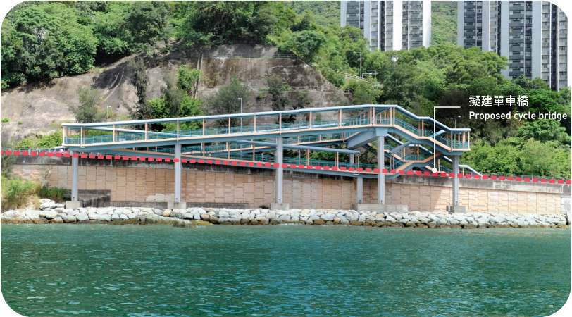
Due to the limited space available on both sides of Castle Peak Road, in order to reduce the impact on the Castle Peak Road and the existing footpath, some sections of the proposed cycle track will necessitate the construction of cycle bridges, subways, or retaining walls along the seafront. By making good use of the existing footpath along Castle Peak Road, some sections of cycle track will be constructed towards the sea, so that construction cost and impact to the existing seawalls and slopes can be reduced. In order to make the walking experience more enjoyable, footpath will be constructed toward the seaside at some cycle track sections and viewing points will be offered as far as practicable at suitable locations where space permits. A continuous cycle track and footpath will be able to enhance the accessibility of the harbourfront along the Castle Peak Road.
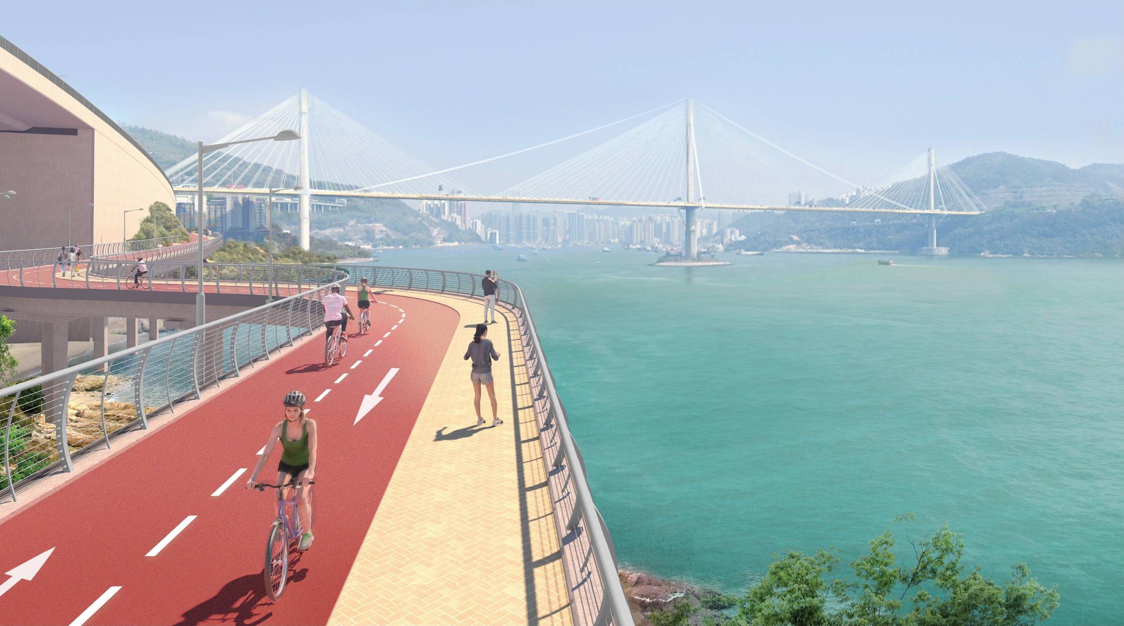

Spatial Arrangement Examples

A seaside cycle track will offer beautiful scenery, overlooking Ting Kau Bridge, Tsing Ma Bridge, Ma Wan Channel and other attractions along the way. Resting stations will be available at appropriate locations to facilitate pedestrians and cyclists to enjoy the beautiful views.
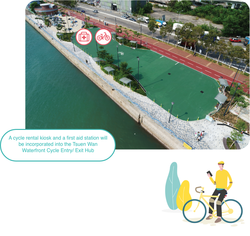
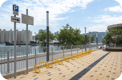
BackApart from the 3 proposed resting stations with cycle parking spaces, we also plan to include a cycling entry / exit hub at Hoi Wing Road, Tuen Mun, to be fitted with cycle practising area, a cycle rental kiosk, drinking facilities, toilets and a first aid station tentatively. The cycling entry /exit hub will be conveniently located near public transport interchanges, facilitating cyclists to gather and disband. Moreover, to tie in with the opening of the entire cycle track section between Tsuen Wan and Tuen Mun, a cycle rental kiosk and a first aid station will be incorporated into the Tsuen Wan Waterfront Cycling Entry/Exit Hub, which is now open for use, and more cycle parking spaces will also be provided at the existing Hoi On Road Resting Station.

Located at the mid-section of the cycle track between Tsuen Wan and Tuen Mun, Sham Tseng is rich in regional characters with stunning sea views. It is a suitable location to provide an en-route stop with cycling support facilities as well as high-quality leisure facilities for the surrounding communities to pursue a healthy lifestyle.
The initial recommendation is to provide a promenade measuring approximately 1km long and 20m wide in Sham Tseng through reclamation to accommodate the cycle track and other leisure and recreational facilities, such as multi-functional space, leisure facilities for the elderly and children, pet-friendly facilities, etc. The new promenade can also provide space for accommodating supporting facilities related to the cycle track, such as cycle parking spaces, a bike repair station, toilets and refreshment kiosks, etc.
Planning Vision
Before we design, shall we first think about our vision?

An Active Living Promenade
Placemaking and Co-creation
Designing the Sham Tseng Promenade is a placemaking process. We can design the Sham Tseng Promenade and create quality public space by tapping the assets, inspirations and potential of the community. We hope that the additional open space will create more possibilities for Sham Tseng residents. To achieve the said objective, we need to first understand the local needs and amass community wisdom. Residents can take up the role of “placemaker” to co-create and foster community values, adding fun to the process of placemaking.
Planning considerations and Opportunities...

Is is possible to integrate the promenade with the existing facilities?

How to let the public enjoy the stunning sunset?

How to make use of the additional open space?

How to design the cycle track so that it blends in with the waterfront?

How to strengthen the connectivity between the waterfront and the hinterland of Sham Tseng?

How to deal with the impact of climate change in order to reduce the risk of flooding?
The cycle track will pass through several existing facilities, some of which will be modified and enhanced as a result of the construction works. We propose to modify the footbridges located near Tsuen Wan Bayview Garden, Yau Kom Tau Pier, Ting Kau Village, Ting Kau Bridge and Tsing Tai Road by replacing the footbridge ramps by lifts to make room for the cycle track as well as to enhance the pedestrian environment.

Illustrative concept for improvement works of the footbridge near Tsuen Wan Bayview Garden
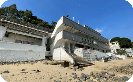
The cycle track will be able to enhance the connectivity among various scenic spots and attractions en route. A direct connection between the proposed cycle track and Homi Villa will be explored to allow cyclists as well as pedestrians to visit the revitalised historical building with ease and convenience.
The Protection of the Harbour Ordinance (PHO) was passed in 1997, stipulating that the Victoria Harbour (the Harbour) is to be protected and preserved as a special public asset and a natural heritage of Hong Kong people, and for that purpose there shall be a presumption against reclamation in the Harbour. Reclamation here means “any works carried out or intended to be carried out for the purpose of forming land from the sea-bed or foreshore” (the specified water level for sea-bed or foreshore is “High Water Mark”(HWM)). Thus, if reclamation works are to be carried out within the Harbour, the relevant reclamation works must comply with the “overriding public need” test stipulated in the Court of the Final Appeal’s judgment in 2004. Public needs include the economic, environmental, and social needs of the community. The part of the Harbour to the east of Ting Kau Bridge falls under the scope of the PHO. Therefore, the proposed cycle track within this area has to comply with the requirements of the PHO.
Some sections of the proposed cycle track need to be built on cycle bridges and the impact of the works on the Harbour has been minimised in the design. However, two locations will have implications under the PHO.
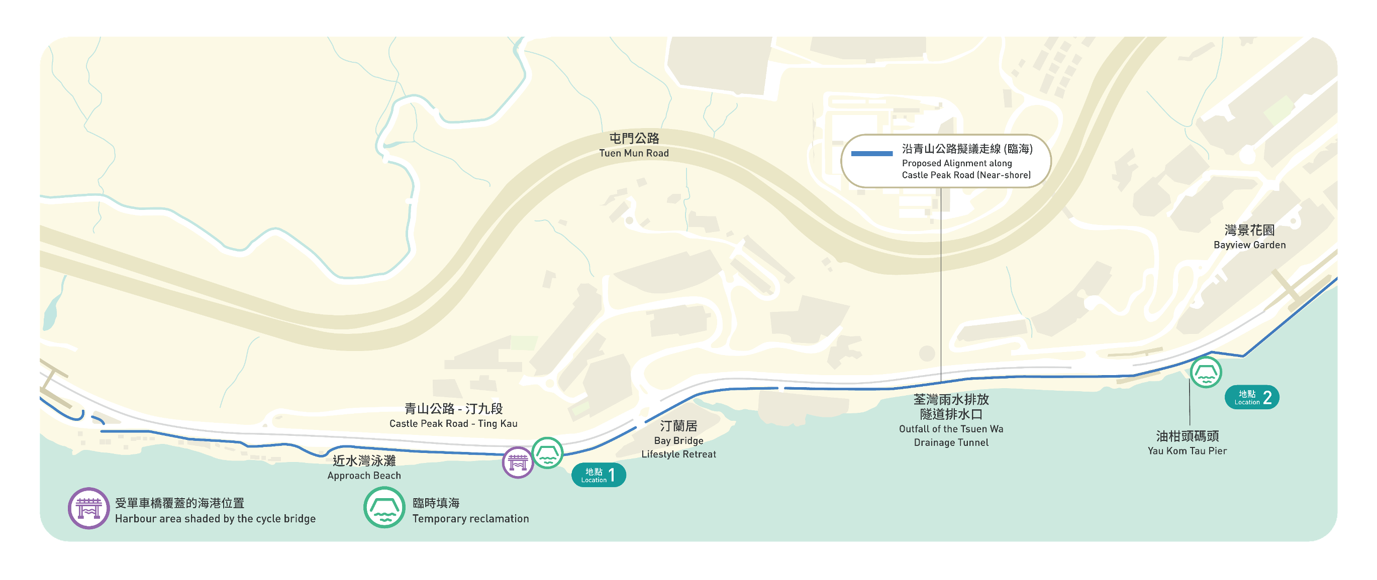
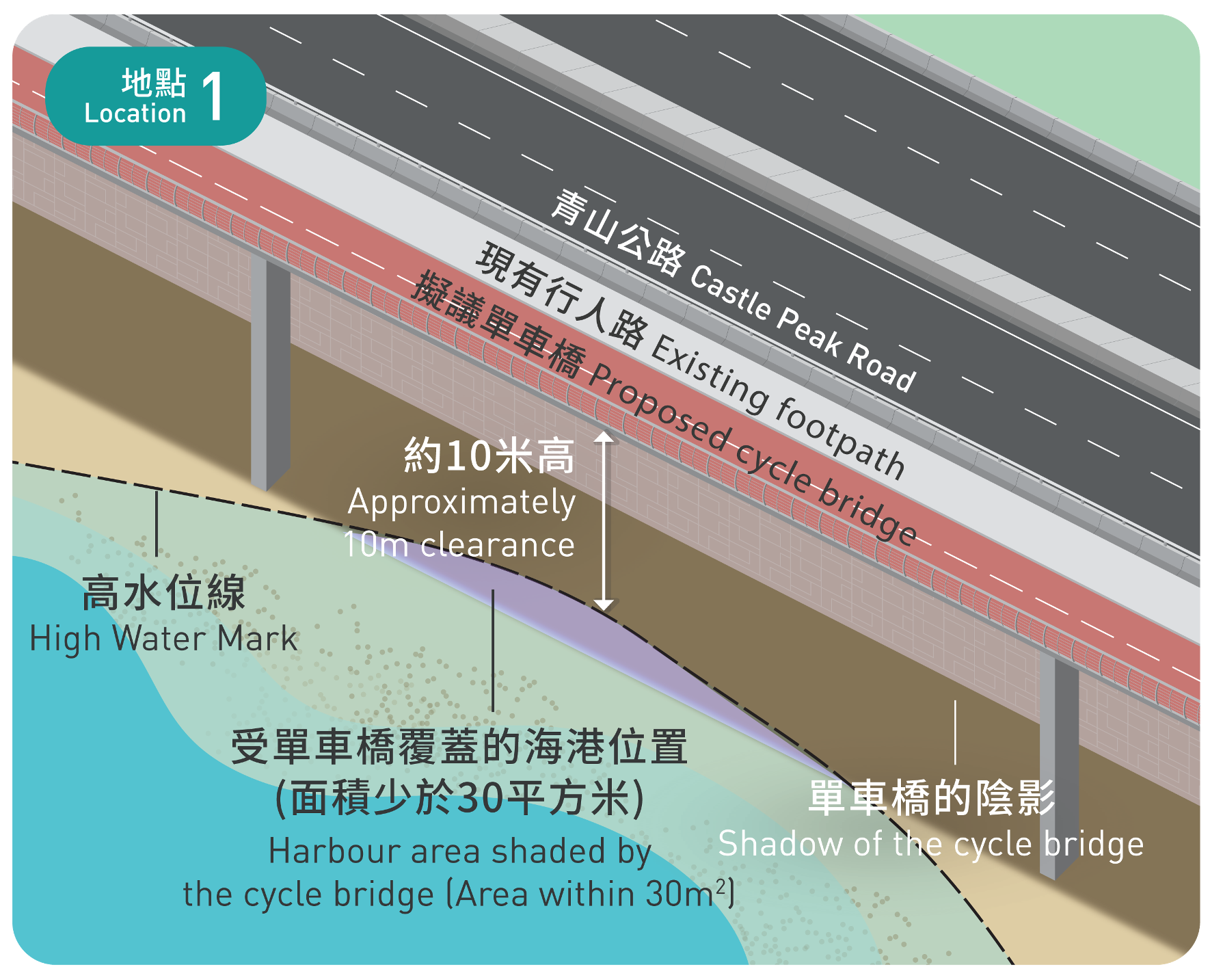
There is a cycle bridge section of around 25m in length at Location 1 (near the Approach Beach), and part of its permanent structure will shade an area of the water surface of the Harbour. However, no land will be formed. The proposed cycle bridge will be approximately 10m above the HWM, so the proposed structure is not expected to cause restrictions to the area underneath the cycle bridge. Since a small part of Harbour area will be shaded by the proposed cycle bridge, it may therefore fall under the scope of the PHO.
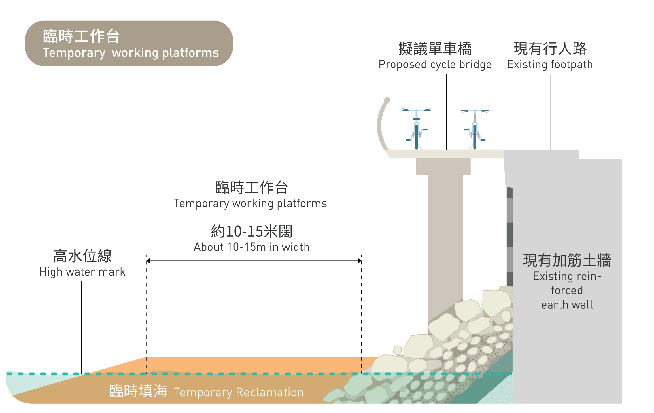
Besides, during construction, erection of temporary working platforms will be required at Location 1 and Location 2 (near Yau Kom Tau Pier) for the construction of permanent cycle bridge structures.
The temporary working platforms will fall under the scope of the PHO even though such works are temporary in nature. We hope to collect public views via public engagement activities. Your valuable feedback and support will help us implement the project in accordance with the PHO, enabling the public to enjoy the vibrant harbourfront.


At location 1 and location 2 of the cycle track, we will optimise the design of cycle bridges so that the permanent piles will be above the HWM at these two locations to avoid permanent reclamation. Only a small part of Harbour area will be shaded by the cycle bridge. We suggest carrying out alteration works to the footbridge near Yau Kom Tau Pier so that the existing piles to the footbridge can act as permanent support for the cycle bridges of the proposed cycle track. This will result in fewer construction works, thus minimising the impact on the Harbour during construction. Upon completion of the works, the temporary working platforms will be removed and the seawall will be reinstated.
The temporary working platforms will be used for the construction of permanent cycle bridge structures.
Based on the preliminary technical assessment, it is estimated that the temporary reclamation will have a total area of about 1 hectare, and may last for about two years.
